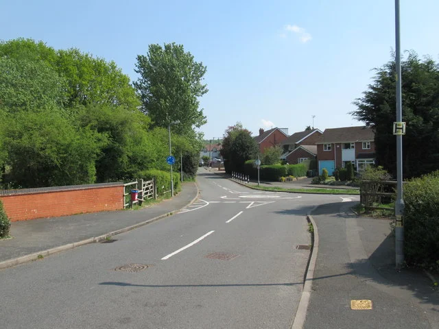

Planners back up to 8 homes on Green Belt off Littleheath Lane, Lickey End, while the flood officer's objection stands. 12 objections, no support.
Bromsgrove District Council planners have recommended that up to eight homes on a Green Belt field off Littleheath Lane, Lickey End be given permission in principle, even though the council’s own flood risk adviser has told them she has not dropped her objection.
The application, 26/00608/PIP, is from H2Land Ltd. It asks for between six and eight homes on 0.48 hectares of land the application form describes as “equestrian/grazing land”. The register lists it as awaiting decision, with an agreed decision date of 10 October 2026.
Twelve people have commented on it. All twelve are objections; none support it, according to the public comments on the register.
A resident wrote to us about the application on Monday. Their concern is what a decision here could lead to:
“Council planners appear to be ‘minded to grant permission’ which could set dangerous precedent and destroy even more local greenbelt.”
What is proposed
The planning statement, written for the applicant by Avon Planning Services, describes the site as “part of an uncultivated agricultural field”. Houses and gardens sit to the west and south, Bromsgrove Garden Centre to the east and the M42 to the north. The homes would be reached from Little Heath Lane as “a small linear development of up to 8no. dwellings”.
The applicant’s statement is plain about the designation: “The site is located within the Green Belt. Lickey End is a village washed over by Green Belt rather than being an inset village.” The council’s report adds that the field is outside the Lickey End settlement boundary drawn in the Bromsgrove District Plan, 19 metres from it to the south and 50 metres to the west.
Permission in principle is a two-stage route for small housing schemes. At this first stage the council may consider only three things: location, land use and the amount of development. Drainage, access, layout and design are left to a second application for “technical details consent”, which must be approved before anything is built.
The flood objection
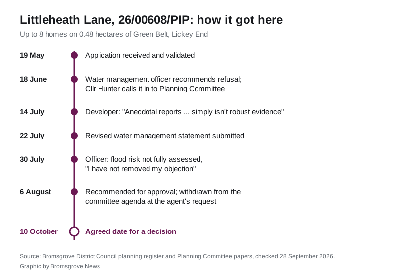
North Worcestershire Water Management, the flood service shared by Bromsgrove, Redditch and Wyre Forest councils, responded on 18 June. Its Senior Water Management Officer, Fiona McIntosh, wrote in her consultee comment that the site is in flood zone 1, the lowest risk of river flooding, “but lies adjacent to an area of flood zone 3 associated with the Spadesbourne Brook”.
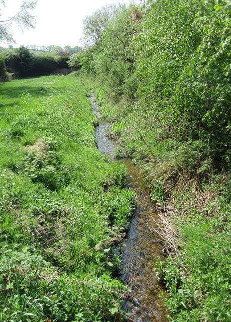
“There is a low-risk and shallow surface water flow path passing through the site from North East to South West. We are aware of reports of flooding in the nearby vicinity, including water flowing off this parcel of land.”
She said the field sits on “loamy and clayey soils with impeded drainage”, so soakaways are “unlikely to be feasible”, and that she understood there is no storm water sewer at that point. Her conclusion:
“I believe that due to the potential flood risk and potential issues with draining the site, further detail is required to confirm that the location and land use in particular are appropriate. I therefore suggest that this application for permission in principle is refused.”
“Anecdotal reports”
The email exchange that followed is published on the register as a single document.
On 14 July Ms McIntosh told the case officer that the applicant’s first water management statement “does not acknowledge the flood risk on site”, and that the nearest adopted storm sewer “is some 80+m from the site”. She maintained that the application should be refused.
The applicant’s agent, Neil Pearce, replied that he would ask the consultants to review her comments, and added:
“Presumably, you will be pointing out to the NWWM that their recommendation is flawed because drainage and flooding is not a PiP issue.”
Ms McIntosh answered that “a PIP application considers the land use and location, of which flood risk is a factor to consider”. H2Land’s director, Mark Donald, then wrote to her:
“Please could you provide the evidence base on which you’re suggesting the site is at risk of flooding. As you confirm, our site is in Flood zone 1. Anecdotal reports of run off/flooding simply isn’t robust evidence.”
Her reply, 18 minutes later:
“We’ve had several reports (since our team formed in 2011) of flooding to a couple of properties on Littleheath Lane, who have independently reference seeding water flow off this parcel of land onto the road which mirrors the surface water flood risk mapping from the EA (albeit that he modelled risk is low).”
She said she did not have time to search the archives for every piece of evidence, but attached one example “showing water flowing from the South West corner of your site and onto the highway”.
A revised water management statement by Reports4Planning, dated 22 July, now says a “narrow strip of shallow surface water flooding is predicted across part of the site” which “can be intercepted and managed” through sustainable drainage, and that flood risk “would not render the site undevelopable”.
Ms McIntosh’s last word, on 30 July, was that the revised statement still fell short:
“While it does now include a statement on flood risk, I do not believe the risk has been fully assessed nor has it been confirmed that mitigation measures would be achievable to sufficiently address the risk of flooding to the proposed properties. I appreciate, having looked at the planning committee notes, that you are minded to grant permission so will make no further comments but do want to be clear that I have not removed my objection to this application.”
Why planners still recommend approval
The case officer’s report to the 6 August Planning Committee concludes that the field counts as “grey belt”, the category of Green Belt land that the 2024 National Planning Policy Framework allows to be built on when certain tests are met. It finds the site makes only a “moderate” contribution to checking sprawl, because it is hemmed in by houses, the lane, the garden centre and the M42, and a “weak” one to keeping towns apart.
Two further reasons carry weight. The council cannot show a five-year supply of housing land, which under the National Planning Policy Framework tilts decisions towards granting. The applicant’s statement puts the district’s figure at 2.24 years. And the report argues flooding belongs to the second stage, citing a June 2026 appeal at 9 Bromsgrove Road, Romsley, where the inspector held that only location, land use and amount are in play at this stage.
On flooding, the report says: “there are some adverse impacts in regarding to flooding, however it would be for the applicant to demonstrate this during the TDC process. This impact would not significantly and demonstrably outweigh the benefits.” Its recommendation: “That the planning in principle stage be GRANTED.”
Worcestershire County Council’s highways team raised no objection. The council’s tree officer said a few trees would have to go for the new access but the “vast majority” of the roadside row could be kept.
Why it went to committee, and what happened
Norton ward councillor Robert Hunter called the application in, so councillors rather than officers will decide it. He gave his reason in an email to the case officer on 18 June:
“My reason for calling in this application is that I believe it is contrary to the Green Belt protections that have historically been in place and the interpretation of the new grey belt policy is subjective.”
It was on the agenda for the 6 August meeting. The minutes record that “this item had been withdrawn from the agenda at the request of the applicant’s agent”. It has not been back since. The next Planning Committee meets on Thursday 8 October at 6pm; its agenda had not been published when we checked on 28 September.
The officer’s report summarised the objections received by then: too many housing applications in the area without the infrastructure to support them, lost wildlife habitat, “recurring flooding” not addressed, the Green Belt, access onto a blind bend, overlooking, no footpaths, construction disruption and the loss of the open buffer between Little Heath Lane and the M42.
Precedent
The resident who wrote to us pointed to H2Land’s own website. On its home page, the company says it works with landowners “to achieve valuable planning consents, either securing initial approvals or improving existing permissions, establishing important precedent on sites which enable development or further planning applications”.
The planning statement says there is “no relevant planning history relating to the site”.
What it means for you
- You can still comment. The formal neighbour consultation closed on 23 August, but the register still takes comments on an application awaiting decision and sends them to the case officer. Use the make a comment page, quoting 26/00608/PIP. Comments must be about planning matters.
- Watch the 8 October agenda. The decision date agreed with the applicant is 10 October, two days later.
- Permission in principle is not the end. If it is granted, H2Land or a buyer would still need technical details consent, and that is where drainage, access and layout are tested in detail.
- If your property floods, report it to North Worcestershire Water Management, the councils’ shared flood service. Ms McIntosh’s evidence here rests on the reports residents have made since 2011.
Other Green Belt applications we are following across the district are on our Bromsgrove planning news page, including Bromsgrove Golf Centre and Buntsford Hill.
Have your say