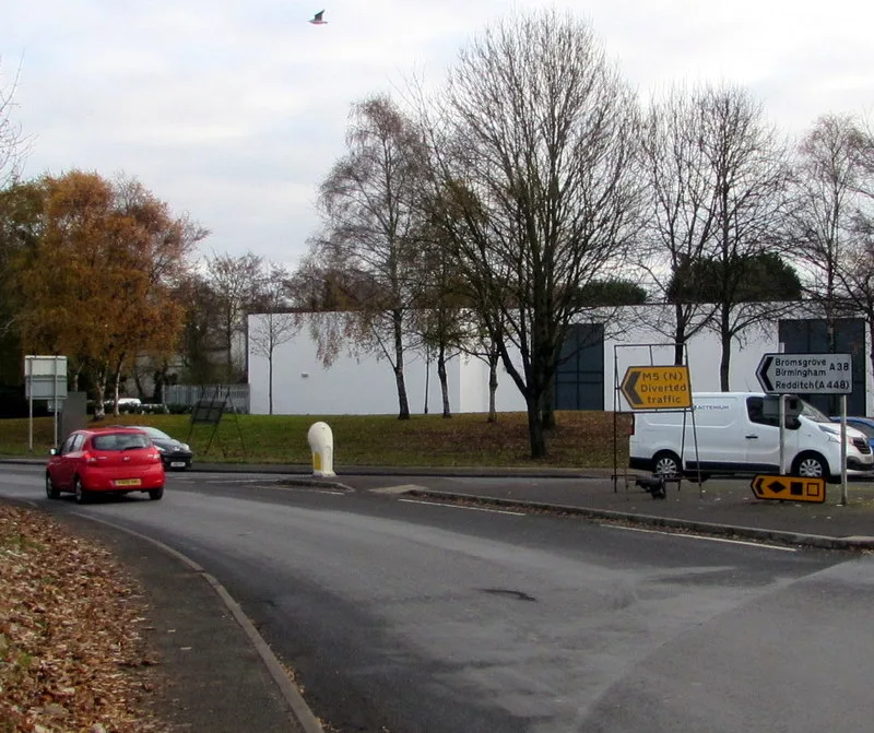

The M5 southbound shuts between junctions 4a and 5 overnight on Thursday, and the M42 link goes with it. Redhill Lane is closed five days from Monday.
This is our weekly check of every live and proposed closure in the district.
The motorway closure at Bromsgrove this week is not a slip road. The M5 southbound carriageway is closed between junction 4a at Lydiate Ash and junction 5 at Wychbold from 21:00 on Thursday 24 September to 06:00 on Friday 25 September. That is the stretch that carries southbound traffic straight past the town, and it shuts for maintenance.
The M42 southbound link from junction 1 down to M5 junction 4a closes on the same night, filed by National Highways under the same scheme. So drivers coming south on the M42 cannot drop onto the M5 southbound and then find a way round it. Both closures are logged with the diversion given only as “via National Highways and local authority network”, with no route named.
Two county closures run into the new week:
- Redhill Lane, Chadwich: 5 days from Monday 21 September, drainage and flood alleviation
- Copyholt Lane, Stoke Pound: 3 days from Monday 21 September, a new water connection
The county has published no new closure notice for the district since 16 September. Its batches have landed on a Wednesday for the last month, so the next one is due after this page is written. Nothing below is carried over on trust: every row is from an order or an official programme, and where we could not reach a source today we say so.
Everything below comes from the statutory closure orders, the National Highways closure report, the county council’s own live highways alerts feed and the two highway authorities’ programmes. It is current on Sunday 20 September 2026.
Closed right now
| Road | Extent | Dates | Reason |
|---|---|---|---|
| The Strand, Bromsgrove (side road) | Side road off The Strand | Closed since 25 January 2026, no end date given | Collapsing building, emergency closure |
| B4096 Old Birmingham Road, Marlbrook | A38 Lickey End roundabout to Linehouse Lane, plus 60m of Staple Flat | 105 days, 24 hours, from 21 July | Gas main replacement, Cadent |
| A38 Bromsgrove Eastern Bypass footway | Slideslow roundabout north 370m to Heart of Worcestershire College | 55 days, 24 hours, from 11 August | Footway rebuild, BREP scheme E |
| Redhill Lane, Chadwich | Birmingham Road to the private road to Chadwick Farm and Grange | 5 days from 21 September | Drainage and flood alleviation, county council |
| Copyholt Lane, Stoke Pound | Upper Gambolds Lane to Sugarbrook Lane | 3 days from 21 September | New water connection, Severn Trent |
| Grange Hill, Halesowen | Southbound traffic banned, northbound only | 6 to 30 September | Carriageway reconstruction, Dudley council |
The oldest closure in Bromsgrove is not a roadworks job at all. A side road off The Strand has been shut since 13:30 on 25 January 2026 because a building beside it is collapsing, and it is still logged as open on the county council’s own live highways alerts feed, which we checked this morning. The county’s entry reads “Shop wall fallen onto footway”. That is close to eight months, and no end date is published. It is the only Bromsgrove item on a feed that currently lists just three emergency closures for the whole county.
Five closures we listed a week ago have run their course. Bromsgrove Road at Romsley, Cofton Church Lane at Cofton Hackett and St Kenelms Pass at Clent were all single-day or single-night orders on 20 and 21 September, and the three days on New Road off Crabtree Lane finished on 17 September.
Grange Hill in Halesowen is not a full closure: it is a one-way restriction, with southbound traffic banned until 30 September. Halesowen is in Dudley borough, about four miles north west of Romsley, and it is in this table because it is the route many drivers from Romsley and Hunnington use.
Old Birmingham Road is the one to plan around. It is a through route, not a side street, and it is closed 24 hours a day rather than overnight. The signed diversion is long: A38 Lickey End roundabout, A38 Birmingham Road, A38 Halesowen Road, Lydiate Ash roundabout, A38 Birmingham Road into Birmingham, then Lickey Road and Rose Hill to rejoin. Staple Flat is closed for 60 metres from its junction with Old Birmingham Road, and its own diversion runs through Linehouse Lane. The order was made for a maximum of 18 months; the anticipated duration is 105 days from 21 July, which runs to about 3 November.
The A38 footway closure is a footway, not the carriageway. Pedestrians heading north from Slideslow roundabout towards Heart of Worcestershire College are sent the long way round via Regents Park Road, Stratford Road, Blackwood Road and the unnamed footpath alongside the college. Its 55 days from 11 August run to about 5 October, so it has about a fortnight left on the order.
The two lanes still shut this week
Redhill Lane at Chadwich is a flood job, not a utility dig. It is the county working on a lane that floods, closed for five days from Monday 21 September between Birmingham Road and the private road to Chadwick Farm and Grange. The closure buys something afterwards, which is more than most of this list can say.
Copyholt Lane at Stoke Pound is shut for three days from the same Monday, between Upper Gambolds Lane and Sugarbrook Lane, for a new Severn Trent water connection.
Both were confirmed as made orders in the county’s notice of 16 September, which means the county has decided them rather than merely advertised them.
What is advertised for October
Two county notices, of 9 and 16 September, have put a run of closures into October. Every one of these is a proposed order.
| Road | From | Duration | Reason |
|---|---|---|---|
| Fox Lane, Bromsgrove (B4091 Rock Hill to Breakback Road) | 3 October | 2 days | Utility work, Severn Trent |
| Barnsley Road, Bromsgrove (Birmingham Road to Walton Road) | 5 October | 2 days | Remedial work to a carriageway defect, Severn Trent |
| Mearse Lane, Barnt Green (Brookhouse Road to Plymouth Road) | 5 October | 3 days | Dropped kerb for a new vehicle crossing, county council |
| A448 Kidderminster Road layby, Dodford | 5 October | 1 day | Footway siding, county council |
| Brockhill Lane, Tardebigge (B4096 Hewell Lane to Tunnel Hill) | 6 October | 2 days | Utility work, Severn Trent |
| Church Road and Chadcote Way, Catshill | 7 October | 3 days | Utility work, Severn Trent |
| Old Birmingham Road, Alvechurch (Roberts Corner roundabout to Jays Crescent) | 12 October | 12 days | Parapet repair after a road traffic collision, county council |
| Mearse Lane, Barnt Green (Brookhouse Road to Plymouth Road) | 13 October | 1 day | Telegraph pole replacement, Openreach |
| Pikes Pool Lane, Burcot (240m south of the B4096 Alcester Road) | 14 October | 2 days | Utility work, Severn Trent |
Three are worth flagging now.
The Alvechurch closure is a different Old Birmingham Road. It is the short stretch by the Roberts Corner roundabout, not the B4096 at Marlbrook that has been shut since July. It is also the longest new job on the list, at 12 days, and the notice warns there is no access for emergency services. The diversion is short: Roberts Corner roundabout, the B4120 Redditch Road and Jays Crescent.
Mearse Lane in Barnt Green is booked twice in eight days: three days from 5 October for a dropped kerb, then a day on 13 October for an Openreach pole. Both use the same diversion via Brookhouse Road, Shepley Road, Twatling Road and Plymouth Road.
Fox Lane is the awkward one. Closing it between Rock Hill and Breakback Road sends traffic the whole way round Rock Hill, Worcester Road, Hanover Street, the A448 Kidderminster Road and Whitford Road. That is a long formal diversion for a two-day job on a residential lane.
A proposed order is an intention, not a decision. The county can move or drop those dates.
The motorways: the main carriageway goes on Thursday
The National Highways closure report for 18 to 24 September puts one closure on the district’s own stretch of motorway, and it is a carriageway rather than a slip road.
- M5 southbound, junction 4a to junction 5: closed from 21:00 on Thursday 24 September to 06:00 on Friday 25 September, for maintenance.
- M42 southbound, junction 1 to the M5 junction 4a links: closed on the same night, 21:00 to 06:00, filed under the same scheme.
Junction 4a at Lydiate Ash is where the M42 meets the M5 at the top of the district. Junction 5 is at Wychbold, south of Droitwich. Closing the southbound carriageway between them takes out the run that carries traffic down the eastern side of Bromsgrove, and closing the M42 link at the same time removes the obvious way of joining it. National Highways gives the diversion for both as “via National Highways and local authority network” and names no roads.
The M5 southbound junction 4 exit slip was closed overnight on 20 September under the previous week’s report. That closure has ended.
Nothing else on the M5 or the M42 between Lydiate Ash, Hopwood and Wythall is closed in the report week. The other M42 closures are all east of the district, around Birmingham Airport, the NEC and the M6 junction 7a link.
One motorway order still affects the run north. National Highways gave notice on 10 September that it intends to close the M5 between junction 1 at West Bromwich and junction 3 at Halesowen, in both directions, from Friday 2 October for about eight days of overnight closures. That stretch is in Sandwell and Dudley, about seven miles north of junction 4. The work is sign replacement, the closures run 21:00 to 06:00 on weeknights and longer at weekends, and the signed diversion uses the A4252, A457, A4123 and A456.
The M5 junction 4a to M42 junction 3 drainage scheme is the standing order behind Thursday’s closure. National Highways made it on 7 August for overnight closures, 21:00 to 06:00, for about six months from 10 August, and Thursday is the first night under it to reach the weekly report. When the main carriageway closes, the order’s own signed diversion runs via the A38, the A448, the A441, the A4023 and the A435, which puts motorway traffic onto the same Bromsgrove roads the BREP works are rebuilding.
The A38 scheme behind most of it
The A38 Bromsgrove Route Enhancement Programme, or BREP, is a £49.7 million rebuild of the road that carries traffic round the town. Phase 3 has been in delivery since 2025.
There are now three published finish dates and none of them is this year. The council’s frequently asked questions said “end of 2026” when we checked on 3 September; on 10 September the same page reads “the end of March 2027”. The programme page the council updated in July 2026 says some activities will continue into spring 2027. And in a letter of 4 September the Minister for Roads gave the majority of the programme as early 2027, with Oakalls Roundabout finishing in summer 2027. We have set the three side by side: what the Minister told Bromsgrove’s MP.
BREP phase 3 covers the A38 between junction 4 of the M5 in the north and the A38 junction with the B4094 in the south. It is junction capacity work, localised widening, new crossings, bus priority and an active travel route between the railway station and the town centre. Colas is the main contractor, working with Griffiths and Journeo Passenger Systems.
| Item | Amount |
|---|---|
| Department for Transport | £43,164,981 |
| Worcestershire Local Enterprise Partnership | £1,317,293 |
| Developer contributions (section 106) | £5,216,238 |
| Total programme | £49,698,512 |
| Spent to the end of July 2026 | £34,666,977 |
Roughly £1 in every £10 of the programme is developer money, which is the practical link between the roadworks and the housing debate: the junctions are being enlarged partly because more homes are coming, and some of the homes are paying for it.
The council is candid about why the dates have moved. Its July update blames “further diversion works required of gas, water and electricity services due to inaccurate utility location records”, and says the timing of those sits with the utility companies rather than with the highway contractor. The next programme update is promised for October 2026. Our separate report sets out what the county says about penalties for the delay.
What BREP is advertising next
| Location | Scheme | Dates | Closure type and status |
|---|---|---|---|
| A38 north of Oakalls, Oakalls roundabout to Slideslow roundabout | E | 5 to 9 October | Weeknight closures, preparation for traffic to run on the new northbound carriageway. Planned |
| A38 south of Oakalls, New Road junction to Oakalls roundabout | E | 9 to 12 October | Weeknight closures, partial construction of the south splitter island. Planned |
| Stoke Road | C | 12 to 17 and 19 to 24 October | Weeknight closures, central splitter island and surfacing. Proposed, to be confirmed |
| New Road, junction link east of the A38 | D | 2 to 7 November | Weeknight closures, amending the temporary layout and surfacing widened carriageway. Planned |
| A38 Stoke Road, Aldi exit to the south | B | 14 to 16 and 21 to 23 November | Weekend night closures, traffic management switch from phase 1 to phase 2. Proposed, to be confirmed |
| Charford Road, Stoke Road junction to Lyttleton Road junction | C | 16 to 21 November | Weeknight closures, resurfacing, duct crossings and lining. Proposed, to be confirmed |
| A448 Stratford Road | E | 7 to 12 December | Weeknight closures, switch of works phase for splitter island work. Proposed, to be confirmed |
| A448 Highway dual carriageway | E | 14 to 20 December | Weeknight closures, surfacing, lining, ducting and signage. Proposed, to be confirmed |
The A448 Stratford Road closure has moved by more than two months. When we read the same table on 17 September it gave 2 October, and it was the first BREP closure of the autumn. It now reads 7 to 12 December, and a second A448 entry has appeared behind it for 14 to 20 December. Nothing on the A448 is booked before December.
That makes 5 October the first BREP closure of the autumn, on the A38 north of the Oakalls roundabout.
Two other rows moved:
- the Aldi exit weekend closures have slipped from 24 October to 9 November, as the table gave them last week, to 14 to 16 and 21 to 23 November
- New Road and Charford Road are new entries, in the first three weeks of November
Stoke Road is still the one to watch. On these dates it sits under weeknight closures for most of the second half of October, and the work then moves round to Charford Road and the Aldi exit in November. Taken together, the table now runs to 20 December, where a week ago it stopped in early November.
The council’s “latest news” page still leads on the Charford Road closure of 27 to 29 August. The page is a programme record rather than a live traffic bulletin. Use the county’s statutory notices for what is actually shut.
The pattern to expect through the autumn is the one the council has used all year: night closures between 20:00 and 06:00, weekend closures from Friday evening to Monday morning, and signed A-road diversions rather than routes through residential streets.
Sanders Park car park works
Separately from the A38, Bromsgrove District Council is extending the overflow car park at Sanders Park. Work started on Monday 17 August 2026, and the council’s page for the scheme says it “will be completed around early October 2026”.
The finished job should add 23 standard bays and 6 disabled bays to the current provision, along with new drainage, kerbs, footpaths and resurfacing. The contractor is Macdonald Surfacing, working 08:00 to 17:00 on weekdays only, with no evening or weekend working. Expect construction traffic, dust and a temporary one-way arrangement inside the car park. The park itself stays open.
Parking, and the car park that closes on 25 September
Bromsgrove District Council runs ten car parks in and around the town. Every public one gives the first 30 minutes free, as long as you take a ticket from the machine.
One is going. The council advertised a new Off-Street Parking Places Order on 14 August which removes Stourbridge Road car park, and its consultation page says the site “will no longer be available for use as a car park from 25th September 2026”. The new order comes into effect the same day, and there are no changes to any of the charges. Objections closed on 4 September and the council had still not published a decision when we checked the consultation page on 20 September, five days before the car park is due to shut. We have covered it in full: Stourbridge Road car park closes on 25 September.
Season ticket holders should note the council’s own list of where a ticket will still be valid after 25 September:
- School Drive
- Parkside
- North Bromsgrove
- New Road
| Car park | Spaces (accessible) | 1 hour | 3 hours | All day |
|---|---|---|---|---|
| Recreation Road South | 292 (20) | £1.00 | £3.00 | £11.00 (10 hrs) |
| North Bromsgrove | 185 (10) | £1.00 | £3.00 | £6.00 (10 hrs) |
| School Drive | 128 (10) | £1.00 | £3.00 | £6.00 (10 hrs) |
| Parkside | 94 (6) | £1.00 | £3.00 | £6.00 (10 hrs) |
| St John Street | 82 (4) | £1.30 | £3.80 | 3-hour maximum |
| Stourbridge Road | 71 (5) | £1.00 | £3.00 | £6.00 (10 hrs) |
| Windsor Street | 65 (6) | £1.30 | £3.80 | 3-hour maximum |
| New Road | 58 (4) | £1.00 | £3.00 | £6.00 (10 hrs) |
| Aston Fields | Not stated | Free for 3 hours, all day with a permit | ||
Stourbridge Road is in that table until 25 September and not after it. The tariffs elsewhere are unchanged in the draft order.
Two other things stand out. Recreation Road South is nearly twice the price of the others for a long stay, £11 against £6, despite being the biggest car park in the town. And St John Street and Windsor Street are the two 3-hour car parks, priced higher per hour precisely because they are meant to turn over. Blue Badge holders park free everywhere, though in the two 3-hour car parks that free parking is itself capped at three hours.
Bromsgrove has no park and ride site. The station car park is the nearest thing to one: 350 spaces on New Road at £3 a day, run by Excel Parking rather than the council, and covered on our Bromsgrove train times page.
The routes that carry the town
- The A38 is the spine. It runs from junction 4 of the M5 at Bromsgrove’s northern edge, past Catshill and along the eastern side of the town through the Slideslow, Oakalls, Buntsford Drive and Sherwood Road junctions, and on south towards Droitwich. Almost every BREP closure is on it or on a road feeding it.
- The M5 at junction 4 is the town’s main motorway access. The M42 joins the M5 immediately north of it at junction 4a, which is why so much cross-region traffic funnels past Bromsgrove rather than round it, and why the junction 4a drainage works matter here.
- The A448 links Bromsgrove east to Redditch and west to Kidderminster. The Bromsgrove Highway stretch between the Oakalls roundabout and the Foxlydiate junction has had repeated overnight closures under BREP scheme E.
- The A491 runs north west towards Hagley and Stourbridge, the way most of the district’s western villages reach the town.
- Local roads to watch during closures: Stoke Road, Sherwood Road, New Road, Regents Park Road, Churchfields and Buntsford Drive have all carried closures or multi-way lights this year.
What it means for you
- If you drive the M5 southbound past Bromsgrove late on Thursday 24 September, the carriageway between junction 4a and junction 5 is shut from 21:00 until 06:00. The M42 southbound link to junction 4a goes at the same time, so coming off the M42 is not a way round it.
- If Redhill Lane at Chadwich is your route, it is shut for five days from Monday 21 September.
- If you use Copyholt Lane at Stoke Pound, it is shut for three days from the same Monday.
- If Old Birmingham Road is your route into Marlbrook or Lickey End, assume it is closed until about 3 November and build the A38 diversion into your journey time.
- If you walk the A38 Eastern Bypass footway to Heart of Worcestershire College, the order has about a fortnight left on it.
- Nothing on the A448 is now booked before December. The 2 October closure has moved.
- If Stoke Road is your road, expect weeknight closures from 12 October.
- If you park at Stourbridge Road, find an alternative before Friday 25 September. The council has still not published a decision on the order that removes it.
- Anything above marked proposed can move, and this month it has. Check the county’s notice before you build a journey around it.
Frequently asked questions
Is the M5 closed at Bromsgrove this week?
Yes, for one night. The National Highways closure report for 18 to 24 September lists the M5 southbound carriageway between junction 4a and junction 5 as closed from 21:00 on Thursday 24 September to 06:00 on Friday 25 September, with the M42 southbound link to junction 4a shut on the same night. No diversion route is named in the report. Nothing else on the M5 or M42 near Bromsgrove is closed that week. The next M5 order to the north is junction 3 to junction 1, in Dudley and Sandwell, from 2 October.
How long is Old Birmingham Road at Marlbrook closed for?
The closure order gives an anticipated duration of 105 days from 21 July 2026, which runs to about 3 November. Cadent is replacing a gas main. The order itself allows up to 18 months if the work overruns.
When are the next A38 night closures in Bromsgrove?
The county council’s upcoming works table gives 5 to 9 October on the A38 north of the Oakalls roundabout, then 9 to 12 October south of it. Those are now the first BREP closures of the autumn: the A448 Stratford Road closure that the same table gave for 2 October has moved to 7 to 12 December. All are marked planned or proposed and subject to confirmation.
When will the Bromsgrove A38 roadworks finish?
The newest answer is the Minister for Roads’, in a letter of 4 September 2026: the majority of the programme in early 2027, and Oakalls Roundabout in summer 2027. The council’s own FAQ page gives the end of March 2027, and its phase 3 page says some activities continue into spring 2027. The council has promised its next programme update in October 2026.
Why is the A38 work taking so long?
The council’s stated reason is utility diversions. Gas, water and electricity apparatus has repeatedly turned up in places the records did not show, which stops work while the utility companies deal with it. In a letter to the town’s MP on 14 August the cabinet member for highways named Cadent gas apparatus as the principal factor.
How much is the A38 Bromsgrove scheme costing?
£49,698,512 in total. The Department for Transport is putting in £43,164,981, developers £5,216,238 through section 106 agreements, and the Worcestershire Local Enterprise Partnership £1,317,293. By the end of July 2026, £34,666,977 had been spent.
Where can I park free in Bromsgrove?
The first 30 minutes is free in every public council car park if you take a ticket. Aston Fields is free for up to three hours, and the Alvechurch, Aston Road and Sanders Park car parks carry no charges at all. Blue Badge holders park free in all of them, with a three-hour cap at St John Street and Windsor Street.
Related
- The Minister says Oakalls runs to summer 2027: four published finish dates, and the refusal to hand the job to National Highways.
- What the county says about penalties for the BREP delay: the contract terms, in the cabinet member’s own letter.
- Stourbridge Road car park closes on 25 September: 71 spaces, and the scheme replacing them has no permission.
- Bromsgrove train times: 23 minutes to Birmingham, and what station parking costs.
- Bromsgrove planning news: the housing growth the A38 junctions are being enlarged for.
- Things to do in Bromsgrove: including Sanders Park, where the car park works are.
- Bromsgrove house prices.
Sources
- National Highways road closure report, the seven-day spreadsheet covering 18 to 24 September 2026, read row by row for every M5, M42 and M6 closure in the West Midlands.
- Worcestershire County Council live highways alerts and the council’s own highways mapping service, read on 20 September 2026, for The Strand emergency closure, its 25 January 2026 start and the county’s “Shop wall fallen onto footway” entry.
- Worcestershire County Council statutory notice, 16 September 2026 for the made Bromsgrove Road Romsley, Cofton Church Lane, Redhill Lane, Copyholt Lane, St Kenelms Pass and Broome Hill orders, and the proposed Mearse Lane (13 October) and Pikes Pool Lane orders.
- Worcestershire County Council statutory notice, 16 September 2026 for the proposed Old Birmingham Road, Alvechurch order.
- Worcestershire County Council, latest news and progress on the A38 Bromsgrove improvements for the upcoming works table, read from the page source on 20 September 2026, and the Charford Road entry it still leads on.
- Worcestershire County Council statutory notice, 26 August 2026 for the first proposed versions of the Romsley, Cofton Church Lane, Redhill Lane, Copyholt Lane, St Kenelms Pass and Broome Hill orders.
- Worcestershire County Council statutory notice, 9 September 2026 for the made Wellington Road and New Road orders, and the proposed Fox Lane, Barnsley Road, Mearse Lane (5 October), Brockhill Lane, Catshill Church Road and A448 Dodford layby orders.
- Worcestershire County Council statutory notice, 9 September 2026 for the made Barkers Lane, Wythall order.
- National Highways statutory notice, 10 September 2026 for the M5 junction 1 to junction 3 order, its 2 October start, the eight-day duration and the A4252, A457, A4123 and A456 diversion.
- Worcestershire County Council statutory notice, 12 August 2026 for the A38 Eastern Bypass footway order.
- Worcestershire County Council statutory notice, 5 August 2026 for the Old Birmingham Road and Staple Flat order.
- Dudley Metropolitan Borough Council notice, 27 August 2026 for the Grange Hill, Halesowen one-way restriction.
- National Highways statutory notice, 5 August 2026 for the M5 junction 4a to M42 junction 3 order, its six-month duration and the A38, A448, A441, A4023 and A435 diversion.
- Worcestershire County Council, Phase 3 of A38 BREP improvements for the funding breakdown, the spend to end July 2026, the scheme extent, the contractors and the spring 2027 statement.
- Worcestershire County Council, BREP frequently asked questions for the end of March 2027 completion statement, checked again 20 September 2026.
- Letter from Justin Madders MP, Minister for Roads, to Bradley Thomas MP, 4 September 2026 for the early 2027 and summer 2027 dates.
- Letter from Cllr Tom Wells to Bradley Thomas MP, 14 August 2026 for the reference to Cadent gas apparatus as the principal factor.
- Bromsgrove District Council, work to begin on Sanders Park car park extension for the 17 August start, the bay numbers and the working hours.
- Bromsgrove District Council, Sanders Park Car Park Works, read 20 September 2026, for the “completed around early October 2026” statement.
- Bromsgrove District Council, Off Street Parking Order 2026 consultation for the 25 September effective date, the removal of Stourbridge Road and the four car parks where season tickets stay valid.
- Bromsgrove District Council, our car parks for the car park tariffs and space counts.
Last checked 20 September 2026. Closure dates move. Check the county council’s notice or the BREP page before you plan a journey around any of these, particularly anything marked proposed or to be confirmed.
Have your say